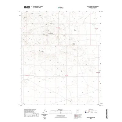
2020 Map of South Pyramid Peak
USGS Topo · Published 2020About this map
South Pyramid Peak and the surrounding Pyramid Mountains dominate this high-desert landscape in southwestern New Mexico. The survey reveals a complex network of drainage systems and ephemeral water sources critical to this arid region, including Uhl Draw, Rainbow Wash, and the aptly named China Pond. Landforms often bear the names of early residents or descriptive landmarks, such as Pinkey Wright Mtn, Elephant Back Hill, and Kirk Peak.
Find a feature on this map
28 named features on this map. Tap any name to fly to it.
Don’t see what you’re looking for? This feature index may not catch every label — zoom into the map to look around manually.
Map Details
Editions of this 2020 South Pyramid Peak Map
This is the sole edition of this map. No revisions or reprints were ever made.
Other maps of this area

1918 · Playas
USGS Topo · 1:62,500

1918 · Pratt
USGS Topo · 1:62,500

1919 · Pratt
USGS Topo · 1:62,500

1919 · Playas
USGS Topo · 1:62,500

1954 · Silver City
USGS Topo · 1:250,000

1955 · Douglas
USGS Topo · 1:250,000

1958 · Silver City
USGS Topo · 1:250,000

1959 · Douglas
USGS Topo · 1:250,000

1961 · Douglas
USGS Topo · 1:250,000

1962 · Silver City
USGS Topo · 1:250,000