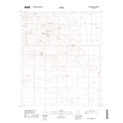
2023 Map of South Pyramid Peak
USGS Topo · Published 2023About this map
South Pyramid Peak and the southern reaches of the Pyramid Mountains define this arid landscape in Hidalgo County. This USGS topographic survey highlights a network of ephemeral drainage systems and man-made water catchments essential for ranching in the high desert. Notable draws like Pride Draw, Uhl Draw, and South Uhl Draw cut through the terrain, punctuated by family-named landmarks such as Pinkey Wright Mountain and Pinkey Wright Canyon. Small-scale water features including Bigote Tank, Middle Tank, and China Pond serve as vital landmarks across the open range. The map reveals the relationship between topographically significant summits like Kirk Peak and the industrial infrastructure represented by Curry Rd, which provides access to the remote canyons and hills including the Russel Hills and Elephant Back Hill.
Find a feature on this map
28 named features on this map. Tap any name to fly to it.
Don’t see what you’re looking for? This feature index may not catch every label — zoom into the map to look around manually.
Map Details
Editions of this 2023 South Pyramid Peak Map
This is the sole edition of this map. No revisions or reprints were ever made.
Other maps of this area

1918 · Playas
USGS Topo · 1:62,500

1918 · Pratt
USGS Topo · 1:62,500

1919 · Pratt
USGS Topo · 1:62,500

1919 · Playas
USGS Topo · 1:62,500

1954 · Silver City
USGS Topo · 1:250,000

1955 · Douglas
USGS Topo · 1:250,000

1958 · Silver City
USGS Topo · 1:250,000

1959 · Douglas
USGS Topo · 1:250,000

1961 · Douglas
USGS Topo · 1:250,000

1962 · Silver City
USGS Topo · 1:250,000