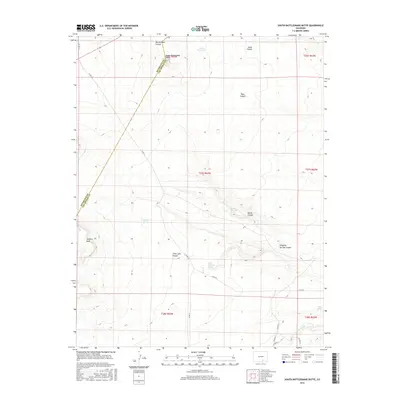
2016 Map of South Rattlesnake Butte
USGS Topo · Published 2016About this map
South Rattlesnake Butte stands as the primary landmark in this section of Las Animas County, overlooking a terrain defined by deep incisions like Rattlesnake Canyon and Jones Lake Canyon. Water management is central to this arid landscape, evidenced by the presence of Baker Reservoir and smaller livestock-related features such as Cordova Tank. The map reveals a network of natural water sources vital for ranching and local wildlife, including Big Dripping Spring, Little Dripping Spring, and Jones Lake Spring. A sparse road system, primarily consisting of routes like Co RD 77 and Co RD 90, connects these isolated points. The boundary between Huerfano and Las Animas counties crosses the northwestern corner, cutting through the high ground of the butte. From Cordova Mesa to the winding Tejana Arroyo in the south, the topography highlights a series of canyons and drainage systems that have dictated the placement of tracks and water improvements in this part of Colorado.
Find a feature on this map
28 named features on this map. Tap any name to fly to it.
Don’t see what you’re looking for? This feature index may not catch every label — zoom into the map to look around manually.
Map Details
Editions of this 2016 South Rattlesnake Butte Map
This is the sole edition of this map. No revisions or reprints were ever made.
Other maps of this area

1891 · Walsenburg
USGS Topo · 1:125,000

1891 · Apishapa
USGS Topo · 1:125,000

1893 · Apishapa
USGS Topo · 1:125,000

1894 · Walsenburg
USGS Topo · 1:125,000

1897 · Walsenburg
USGS Topo · 1:125,000

1897 · Apishapa
USGS Topo · 1:125,000

1900 · Walsenburg
USGS Topo · 1:125,000

1954 · Trinidad
USGS Topo · 1:250,000

1955 · Trinidad
USGS Topo · 1:250,000

1958 · Trinidad
USGS Topo · 1:250,000