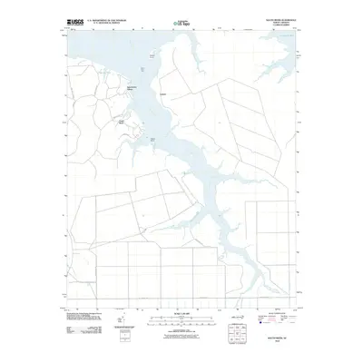
2010 Map of South River
USGS Topo · Published 2010About this map
The South River dominates this coastal landscape, serving as a primary waterway through which numerous tributaries like Eastman Creek and Mulberry Creek drain into Turnagain Bay. Small maritime communities such as Lukens and South River sit along the eastern and western banks, while Sportsmans Village is situated near the northern reach, pointing to the area's recreational and residential character. Navigation along this stretch of the Inner Banks is marked by the South River Light, which guides traffic around Horton Point. The network of roads, including Nelson Bay Rd and S River Rd, provides access to these isolated waterside settlements. Toward the south, the river forks into the West Fork South River and East Fork South River, creating a complex wetland environment characterized by points like Cedar Point and numerous small inlets including Buck Creek.
Find a feature on this map
30 named features on this map. Tap any name to fly to it.
Don’t see what you’re looking for? This feature index may not catch every label — zoom into the map to look around manually.
Map Details
Editions of this 2010 South River Map
This is the sole edition of this map. No revisions or reprints were ever made.
Other maps of this area

1948 · Oriental
USGS Topo · 1:24,000

1949 · Point Of Marsh
USGS Topo · 1:24,000

1949 · Long Bay
USGS Topo · 1:24,000

1949 · Merrimon
USGS Topo · 1:24,000

1949 · Williston
USGS Topo · 1:24,000

1949 · South River
USGS Topo · 1:24,000

1949 · Davis
USGS Topo · 1:24,000

1949 · Core Creek
USGS Topo · 1:24,000

1950 · Long Bay
USGS Topo · 1:24,000

1950 · South River
USGS Topo · 1:24,000