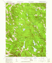
1958 Map of South Sandisfield
USGS Topo · Published 1959About this map
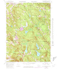
Woodruff Mountain and Higley Hill dominate the highlands of the Berkshires in this late-1950s record of the borderlands between Massachusetts and Connecticut. The landscape is a complex network of glacial ponds and wetlands, including Atwater Pond, York Lake, and the expansive Doolittle Lake to the south. Small settlements like Southfield and Montville are connected by winding forest roads such as the New Marlborough Sandisfield Road, reflecting an era of quiet upland hamlets and established recreation sites like the YMCA Camp near Harmon Pond.
Find a feature on this map
59 named features on this map. Tap any name to fly to it.
Don’t see what you’re looking for? This feature index may not catch every label — zoom into the map to look around manually.
Map Details
Editions of this 1958 South Sandisfield Map
5 editions found
Other maps of this area

1885 · Sheffield
USGS Topo · 1:62,500

1888 · Sheffield
USGS Topo · 1:62,500

1888 · Sandisfield
USGS Topo · 1:62,500

1891 · Sheffield
USGS Topo · 1:62,500

1892 · Winsted
USGS Topo · 1:62,500

1892 · Cornwall
USGS Topo · 1:62,500

1893 · Sheffield
USGS Topo · 1:62,500

1893 · Cornwall
USGS Topo · 1:62,500

1893 · Sandisfield
USGS Topo · 1:62,500

1897 · Sandisfield
USGS Topo · 1:62,500