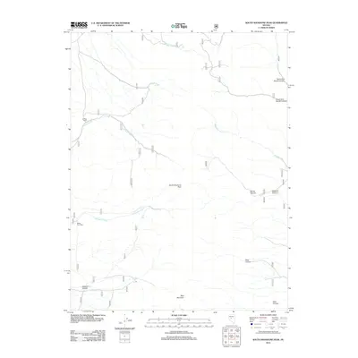
2012 Map of South Shoshone Peak
USGS Topo · Published 2012About this map
Midas Post Office and the isolated Le Beau Ranch anchor this high-elevation landscape in Nye County, where several drainages carve through the terrain. The central high point of South Shoshone Peak and the southern rise of Bald Mountain dominate the topography, which is defined by a network of steep canyons such as Sawmill Canyon, Bonita Canyon, and Deep Canyon. Local hydrology is characterized by seasonal flows like Sunnyside Creek and Lebeau Creek, which snake through the lower elevations.
Find a feature on this map
15 named features on this map. Tap any name to fly to it.
Don’t see what you’re looking for? This feature index may not catch every label — zoom into the map to look around manually.
Map Details
Editions of this 2012 South Shoshone Peak Map
This is the sole edition of this map. No revisions or reprints were ever made.
Other maps of this area

1907 · Tonopah
USGS Topo · 1:250,000

1908 · Tonopah
USGS Topo · 1:250,000

1948 · Ione
USGS Topo · 1:62,500

1950 · Ione
USGS Topo · 1:62,500

1955 · Millett
USGS Topo · 1:250,000

1956 · South Shoshone Peak
USGS Topo · 1:62,500

1956 · North Shoshone Peak
USGS Topo · 1:62,500

1956 · Tonopah
USGS Topo · 1:250,000

1959 · Tonopah
USGS Topo · 1:250,000

1959 · Millett
USGS Topo · 1:250,000