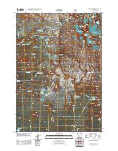
2011 Map of South Sister
USGS Topo · Published 2011About this map
The summit of South Sister and its surrounding glacial systems dominate this high-elevation landscape in the Central Cascades. Several prominent ice masses are mapped in detail, including the Skinner Glacier, Eugene Glacier, and Prouty Glacier, which drain into high alpine basins like Teardrop Pool. The presence of the James Creek Shelter and Satan Creek Forest Camp indicates the area's significance for early 21st-century recreation and backcountry travel. Moving south from the peak, the terrain transitions into the expansive Wickiup Plain and a cluster of small water bodies such as Sisters Mirror Lake and Lancelot Lake. Geological features like Rock Mesa and The House Rock stand out against the drainage patterns of Separation Creek and James Creek. To the southeast, the Cascade Lakes Hwy provides the primary access point near Devils Lake and Talapus Butte.
Find a feature on this map
55 named features on this map. Tap any name to fly to it.
Don’t see what you’re looking for? This feature index may not catch every label — zoom into the map to look around manually.
Map Details
Editions of this 2011 South Sister Map
This is the sole edition of this map. No revisions or reprints were ever made.
Other maps of this area

1929 · Three Sisters
USGS Topo · 1:125,000

1930 · Maiden Peak
USGS Topo · 1:125,000

1932 · Three Sisters
USGS Topo · 1:125,000

1934 · Maiden Peak
USGS Topo · 1:125,000

1955 · Crescent
USGS Topo · 1:250,000

1955 · Bend
USGS Topo · 1:250,000

1957 · Crescent
USGS Topo · 1:250,000

1957 · Bend
USGS Topo · 1:250,000

1958 · Crescent
USGS Topo · 1:250,000

1958 · Bend
USGS Topo · 1:250,000