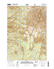
2017 Map of South Sister
USGS Topo · Published 2017About this map
South Sister and the surrounding high peaks of the Cascade Range dominate this 2017 survey, where the border of Lane Co and Deschutes Co follows the crest of the mountains. This alpine environment is defined by its numerous active ice fields, including Skinner Glacier, Eugene Glacier, and Prouty Glacier situated near Hodge Crest. The topographic detail highlights the volcanic origins of the landscape, from the prominent Rock Mesa and Le Conte Crater to the broad expanse of the Wickiup Plain.
Find a feature on this map
87 named features on this map. Tap any name to fly to it.
Don’t see what you’re looking for? This feature index may not catch every label — zoom into the map to look around manually.
Map Details
Editions of this 2017 South Sister Map
This is the sole edition of this map. No revisions or reprints were ever made.
Other maps of this area

1929 · Three Sisters
USGS Topo · 1:125,000

1930 · Maiden Peak
USGS Topo · 1:125,000

1932 · Three Sisters
USGS Topo · 1:125,000

1934 · Maiden Peak
USGS Topo · 1:125,000

1955 · Crescent
USGS Topo · 1:250,000

1955 · Bend
USGS Topo · 1:250,000

1957 · Crescent
USGS Topo · 1:250,000

1957 · Bend
USGS Topo · 1:250,000

1958 · Crescent
USGS Topo · 1:250,000

1958 · Bend
USGS Topo · 1:250,000