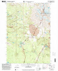
1997 Map of South Sister
USGS Topo · Published 2001About this map
South Sister dominates the Cascade Range landscape in this late 1990s revision, marking the high-altitude boundary between Lane and Deschutes counties. The glacial activity of the era is preserved in the detailed mapping of the Eugene Glacier, Prouty Glacier, and Lost Creek Glacier, which feed into high-mountain waters like Teardrop Pool and Chambers Lakes.
Find a feature on this map
60 named features on this map. Tap any name to fly to it.
Don’t see what you’re looking for? This feature index may not catch every label — zoom into the map to look around manually.
Map Details
Editions of this 1997 South Sister Map
This is the sole edition of this map. No revisions or reprints were ever made.
Other maps of this area

1929 · Three Sisters
USGS Topo · 1:125,000

1930 · Maiden Peak
USGS Topo · 1:125,000

1932 · Three Sisters
USGS Topo · 1:125,000

1934 · Maiden Peak
USGS Topo · 1:125,000

1955 · Crescent
USGS Topo · 1:250,000

1955 · Bend
USGS Topo · 1:250,000

1957 · Crescent
USGS Topo · 1:250,000

1957 · Bend
USGS Topo · 1:250,000

1958 · Crescent
USGS Topo · 1:250,000

1958 · Bend
USGS Topo · 1:250,000