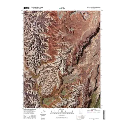
2017 Map of South Six-shooter Peak
USGS Topo · Published 2017About this map
Canyonlands National Park dominates this desert landscape in San Juan County, showcasing a complex network of eroded sandstone formations and ancient travel routes. The high-desert terrain is marked by significant natural spans, including the aptly named Castle Arch, Fortress Arch, and Gunsight Natural Bridge. A web of primitive roads and paths, such as Horse Canyon Road and the Salt Creek Trail, traces the deep drainages of Horse Canyon and Davis Canyon, suggesting the navigational challenges faced by early travelers and surveyors. To the east, the elevation rises toward South Sixshooter Peak and the expansive Bridger Jack Mesa. Named landmarks like Paul Bunyans Potty and Thirteen Faces highlight the colorful local nomenclature applied to these distinct geological features. The presence of Lavender Creek and its seasonal tributaries illustrates the drainage patterns that have sculpted these canyons over millennia.
Find a feature on this map
58 named features on this map. Tap any name to fly to it.
Don’t see what you’re looking for? This feature index may not catch every label — zoom into the map to look around manually.
Map Details
Editions of this 2017 South Six-shooter Peak Map
This is the sole edition of this map. No revisions or reprints were ever made.
Other maps of this area

1885 · La Sal
USGS Topo · 1:250,000

1886 · Abajo
USGS Topo · 1:250,000

1892 · Abajo
USGS Topo · 1:250,000

1893 · Abajo
USGS Topo · 1:250,000

1935 · Elk Ridge
USGS Topo · 1:96,000

1940 · Elk Ridge
USGS Topo · 1:125,000

1953 · The Needles
USGS Topo · 1:62,500

1954 · Elk Ridge 1 NW
USGS Topo · 1:24,000

1954 · Elk Ridge 1 NE
USGS Topo · 1:24,000

1954 · Carlisle 4 SW
USGS Topo · 1:24,000