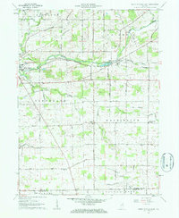
1962 Map of South Whitley East
USGS Topo · Published 1963About this map
The Eel River valley defines the northern landscape of this region, serving as a corridor for both water and rail. The New York Chicago and St Louis and Pennsylvania railroads converge at South Whitley, illustrating the town's role as a mid-century transportation hub for the surrounding agricultural townships. The map documents a dense network of rural community landmarks, including St Johns Ch, Fairview Ch, and Centenary Ch, which anchored the social life of the farming population.
Find a feature on this map
28 named features on this map. Tap any name to fly to it.
Don’t see what you’re looking for? This feature index may not catch every label — zoom into the map to look around manually.
Map Details
Editions of this 1962 South Whitley East Map
2 editions found
Other maps of this area

1950 · Pierceton
USGS Topo · 1:24,000

1953 · Fort Wayne
USGS Topo · 1:250,000

1953 · Muncie
USGS Topo · 1:250,000

1955 · Bippus
USGS Topo · 1:24,000

1955 · Columbia City
USGS Topo · 1:24,000

1956 · Muncie
USGS Topo · 1:250,000

1956 · Fort Wayne
USGS Topo · 1:250,000

1956 · Huntington
USGS Topo · 1:24,000

1956 · Lorane
USGS Topo · 1:24,000
1961 · Servia
USGS Topo · 1:24,000