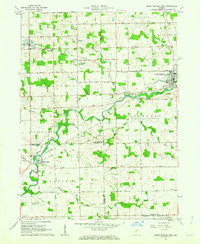
1962 Map of South Whitley West
USGS Topo · Published 1963About this map
The Eel River defines the landscape of this Indiana heartland as it meanders through the corner of Kosciusko, Whitley, Wabash, and Huntington counties. The small settlement of South Whitley serves as a primary hub where the Pennsylvania and the New York Chicago and St Louis RR lines intersect, highlighting the mid-century importance of rail transport for rural agricultural commerce. To the west, the community of Liberty Mills sits along the river banks near a designated Public Fishing Site, while the village of Sidney anchors the northwestern corner near the Township Sch.
Find a feature on this map
40 named features on this map. Tap any name to fly to it.
Don’t see what you’re looking for? This feature index may not catch every label — zoom into the map to look around manually.
Map Details
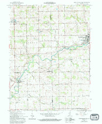
Editions of this 1962 South Whitley West Map
2 editions found
Other maps of this area

1950 · Pierceton
USGS Topo · 1:24,000

1953 · Fort Wayne
USGS Topo · 1:250,000

1953 · Muncie
USGS Topo · 1:250,000

1955 · Bippus
USGS Topo · 1:24,000

1956 · Muncie
USGS Topo · 1:250,000

1956 · Fort Wayne
USGS Topo · 1:250,000

1956 · Lorane
USGS Topo · 1:24,000

1957 · Warsaw
USGS Topo · 1:24,000
1961 · Servia
USGS Topo · 1:24,000
1961 · North Manchester South
USGS Topo · 1:24,000