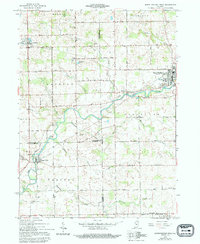
1962 Map of South Whitley West
USGS Topo · Published 1994About this map
The Eel River winds through the heart of northern Indiana's agricultural landscape, serving as a geographic anchor for the settlements of South Whitley, Collamer, and Liberty Mills. This 1962 survey, updated with minor revisions through 1994, captures the rural character of the borderlands between Whitley, Kosciusko, and Wabash counties. The area is defined by a dense network of numbered section roads and natural drainage systems like Hurricane Creek and Clear Creek. Small-town infrastructure is well-preserved here, from the Township Sch in Sidney to the various community centers such as Liberty Ch and Pleasant View Ch. Genealogists will find value in the clearly marked burial grounds including Circle Cem and Union Cem, while the presence of Conrail tracks highlights the enduring role of rail transport in the regional economy. The landscape also features numerous gravel pits and the Public Fishing Site on the river, reflecting the local intersection of industry and recreation.
Find a feature on this map
76 named features on this map. Tap any name to fly to it.
Don’t see what you’re looking for? This feature index may not catch every label — zoom into the map to look around manually.
Map Details
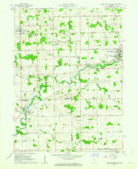
Editions of this 1962 South Whitley West Map
2 editions found
Other maps of this area

1950 · Pierceton
USGS Topo · 1:24,000

1953 · Fort Wayne
USGS Topo · 1:250,000

1953 · Muncie
USGS Topo · 1:250,000

1955 · Bippus
USGS Topo · 1:24,000

1956 · Muncie
USGS Topo · 1:250,000

1956 · Fort Wayne
USGS Topo · 1:250,000

1956 · Lorane
USGS Topo · 1:24,000

1957 · Warsaw
USGS Topo · 1:24,000
1961 · Servia
USGS Topo · 1:24,000
1961 · North Manchester South
USGS Topo · 1:24,000