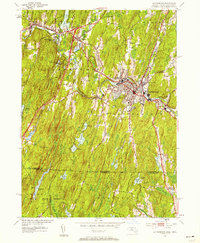
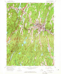
1952 Map of Southbridge
USGS Topo · Published 1958About this map
The Quinebaug River winds through the industrial and residential heart of this region, anchoring the dense development of Southbridge and its surrounding mill villages. In the early 1950s, the landscape reveals a transition between the established manufacturing centers of Globe Village and Sandersdale and the burgeoning heritage tourism at Old Sturbridge Village. The map captures the community's infrastructure in detail, from the West St Sch and Charlton St Sch to the numerous religious and memorial sites like St Marys Cem and Notre Dame Cem.
Find a feature on this map
51 named features on this map. Tap any name to fly to it.
Don’t see what you’re looking for? This feature index may not catch every label — zoom into the map to look around manually.
Map Details
Editions of this 1952 Southbridge Map
5 editions found
Other maps of this area

1887 · Brookfield
USGS Topo · 1:62,500

1889 · Webster
USGS Topo · 1:62,500

1889 · Putnam
USGS Topo · 1:62,500

1890 · Brookfield
USGS Topo · 1:62,500

1892 · Woodstock
USGS Topo · 1:62,500

1892 · Webster
USGS Topo · 1:62,500

1893 · Putnam
USGS Topo · 1:62,500

1893 · Brookfield
USGS Topo · 1:62,500

1908 · Quinsigamond
USGS Topo · 1:125,000

1908 · Ware
USGS Topo · 1:125,000