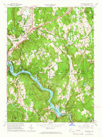
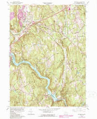
1964 Map of Southbury
USGS Topo · Published 1966About this map
Lake Zoar and the winding Housatonic River dominate this mid-century landscape, providing a clear view of the region's topography before significant suburban expansion. The Stevenson Dam Powerplant at the southern edge marks the industrial control of the river, while the surrounding hills like Mount Pisgah and Rattlesnake Hill define the steep river valley.
Find a feature on this map
64 named features on this map. Tap any name to fly to it.
Don’t see what you’re looking for? This feature index may not catch every label — zoom into the map to look around manually.
Map Details
Editions of this 1964 Southbury Map
5 editions found
Other maps of this area

1889 · Derby
USGS Topo · 1:62,500

1891 · Derby
USGS Topo · 1:62,500

1892 · Danbury
USGS Topo · 1:62,500

1892 · New Milford
USGS Topo · 1:62,500

1893 · Waterbury
USGS Topo · 1:62,500

1893 · New Milford
USGS Topo · 1:62,500

1893 · Derby
USGS Topo · 1:62,500

1904 · New Milford
USGS Topo · 1:62,500

1904 · Waterbury
USGS Topo · 1:62,500

1904 · Litchfield
USGS Topo · 1:125,000