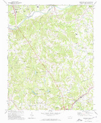
1971 Map of Southeast Eden
USGS Topo · Published 1974About this map
The Dan River corridor defines the northern edge of this North Carolina landscape, where industrial infrastructure like Sewage Disposal ponds and a power plant meet the growing outskirts of Eden. The interior is a dense network of creek valleys and ridges, home to established community landmarks such as Guerrant Springs Ch and Lincoln Sch. Further south, the map details the significant Chinqua Penn Plantation, a site of local historical importance, alongside the Wolf Island Racetrack.
Find a feature on this map
55 named features on this map. Tap any name to fly to it.
Don’t see what you’re looking for? This feature index may not catch every label — zoom into the map to look around manually.
Map Details
Editions of this 1971 Southeast Eden Map
2 editions found
Other maps of this area

1924 · Martinsville
USGS Topo · 1:48,000

1924 · Draper
USGS Topo · 1:48,000

1926 · Martinsville
USGS Topo · 1:62,500

1926 · Draper
USGS Topo · 1:62,500

1927 · Martinsville
USGS Topo · 1:62,500

1944 · Martinsville
USGS Topo · 1:62,500

1944 · Draper
USGS Topo · 1:62,500

1953 · Greensboro
USGS Topo · 1:250,000

1954 · Greensboro
USGS Topo · 1:250,000

1962 · Greensboro
USGS Topo · 1:250,000