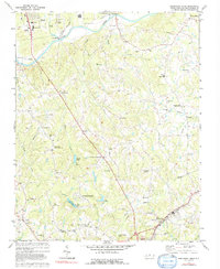
1977 Map of Southeast Eden
USGS Topo · Published 1992About this map
The Dan River carves through the landscape of northern Rockingham County, anchoring a region defined by its transition from industrial hubs like Eden and Reidsville to the rural farming communities of Happy Home and Oregon Hill. This 1970s landscape reveals a network of country churches and family-named landmarks, such as Guerrant Springs Ch and Slaydon Cem, that suggest a deep-rooted local history.
Find a feature on this map
54 named features on this map. Tap any name to fly to it.
Don’t see what you’re looking for? This feature index may not catch every label — zoom into the map to look around manually.
Map Details
Editions of this 1977 Southeast Eden Map
This is the sole edition of this map. No revisions or reprints were ever made.
Other maps of this area

1924 · Martinsville
USGS Topo · 1:48,000

1924 · Draper
USGS Topo · 1:48,000

1926 · Martinsville
USGS Topo · 1:62,500

1926 · Draper
USGS Topo · 1:62,500

1927 · Martinsville
USGS Topo · 1:62,500

1944 · Martinsville
USGS Topo · 1:62,500

1944 · Draper
USGS Topo · 1:62,500

1953 · Greensboro
USGS Topo · 1:250,000

1954 · Greensboro
USGS Topo · 1:250,000

1962 · Greensboro
USGS Topo · 1:250,000