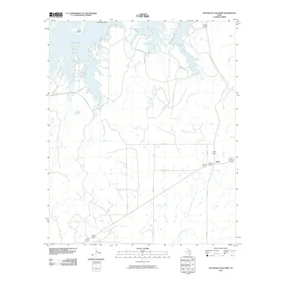
2010 Map of Southeast Lake Kemp
USGS Topo · Published 2010About this map
Lake Kemp dominates the northern reaches of this Baylor County landscape, its indented shoreline giving way to islands like Cattle Island and Rattlesnake Island. This 2010 survey shows a region largely defined by vast ranching tracts and water management, with the North Fork Little Wichita River meandering through the southern half of the quadrangle. The small settlement of Mable sits at a crossroads in the east, served by a network of rural routes including FM Rd 1790. Numerous drainages such as Pony Creek, Big Moonshine Creek, and Little Moonshine Creek flow toward the reservoir, illustrating the complex watershed that feeds the lake. Local infrastructure is primarily composed of ranch roads and county lines, such as Waggoner Rd and Cowboy Rd, which navigate the terrain between the creeks and the lake's edge.
Find a feature on this map
25 named features on this map. Tap any name to fly to it.
Don’t see what you’re looking for? This feature index may not catch every label — zoom into the map to look around manually.
Map Details
Editions of this 2010 Southeast Lake Kemp Map
This is the sole edition of this map. No revisions or reprints were ever made.
Other maps of this area

1954 · Wichita Falls
USGS Topo · 1:250,000

1958 · Wichita Falls
USGS Topo · 1:250,000

1966 · Franklin Bend
USGS Topo · 1:24,000

1966 · Seymour West
USGS Topo · 1:24,000

1966 · Fulda
USGS Topo · 1:24,000

1966 · Northeast Lake Kemp
USGS Topo · 1:24,000

1966 · Southeast Lake Kemp
USGS Topo · 1:24,000

1966 · Northwest Lake Kemp
USGS Topo · 1:24,000

1966 · Southwest Lake Kemp
USGS Topo · 1:24,000

1966 · Seymour East
USGS Topo · 1:24,000