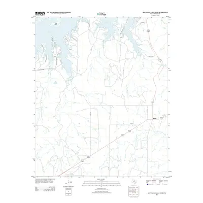
2013 Map of Southeast Lake Kemp
USGS Topo · Published 2013About this map
Lake Kemp dominates the northern reaches of this Texas landscape, its irregular shoreline forming numerous inlets and peninsulas, including the prominent Cattle Island. The surrounding terrain is defined by a dense network of seasonal drainages, most notably Big Moonshine Cr and Little Moonshine Cr, which flow toward the N Fork Little Wichita River in the south. The small settlement of Mabelle serves as a local crossroads where major regional thoroughfares intersect. Further evidence of early 20th-century land development and ranching history appears in the road names, such as Arkansas Colony Rd and Wichita Colony Rd, which hint at organized settlement patterns near the water's edge. To the east, the presence of Waggoner Lake Number 5 reflects the historical influence of the Waggoner ranching interests in this part of Baylor County.
Find a feature on this map
32 named features on this map. Tap any name to fly to it.
Don’t see what you’re looking for? This feature index may not catch every label — zoom into the map to look around manually.
Map Details
Editions of this 2013 Southeast Lake Kemp Map
This is the sole edition of this map. No revisions or reprints were ever made.
Other maps of this area

1954 · Wichita Falls
USGS Topo · 1:250,000

1958 · Wichita Falls
USGS Topo · 1:250,000

1966 · Franklin Bend
USGS Topo · 1:24,000

1966 · Seymour West
USGS Topo · 1:24,000

1966 · Fulda
USGS Topo · 1:24,000

1966 · Northeast Lake Kemp
USGS Topo · 1:24,000

1966 · Southeast Lake Kemp
USGS Topo · 1:24,000

1966 · Northwest Lake Kemp
USGS Topo · 1:24,000

1966 · Southwest Lake Kemp
USGS Topo · 1:24,000

1966 · Seymour East
USGS Topo · 1:24,000