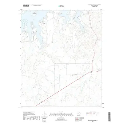
2019 Map of Southeast Lake Kemp
USGS Topo · Published 2019About this map
Mabelle stands as the primary settlement in this corner of Baylor County, situated at the intersection of major regional thoroughfares. The landscape is defined by the southeastern reaches of Lake Kemp, where numerous fingers and inlets like Gray Cr and Pony Cr reach into the surrounding ranch land. The terrain includes Cattle Island and is heavily carved by the drainage systems of Little Moonshine Cr and Big Moonshine Cr, which flow toward the reservoir.
Find a feature on this map
38 named features on this map. Tap any name to fly to it.
Don’t see what you’re looking for? This feature index may not catch every label — zoom into the map to look around manually.
Map Details
Editions of this 2019 Southeast Lake Kemp Map
This is the sole edition of this map. No revisions or reprints were ever made.
Other maps of this area

1954 · Wichita Falls
USGS Topo · 1:250,000

1958 · Wichita Falls
USGS Topo · 1:250,000

1966 · Franklin Bend
USGS Topo · 1:24,000

1966 · Seymour West
USGS Topo · 1:24,000

1966 · Fulda
USGS Topo · 1:24,000

1966 · Northeast Lake Kemp
USGS Topo · 1:24,000

1966 · Southeast Lake Kemp
USGS Topo · 1:24,000

1966 · Northwest Lake Kemp
USGS Topo · 1:24,000

1966 · Southwest Lake Kemp
USGS Topo · 1:24,000

1966 · Seymour East
USGS Topo · 1:24,000