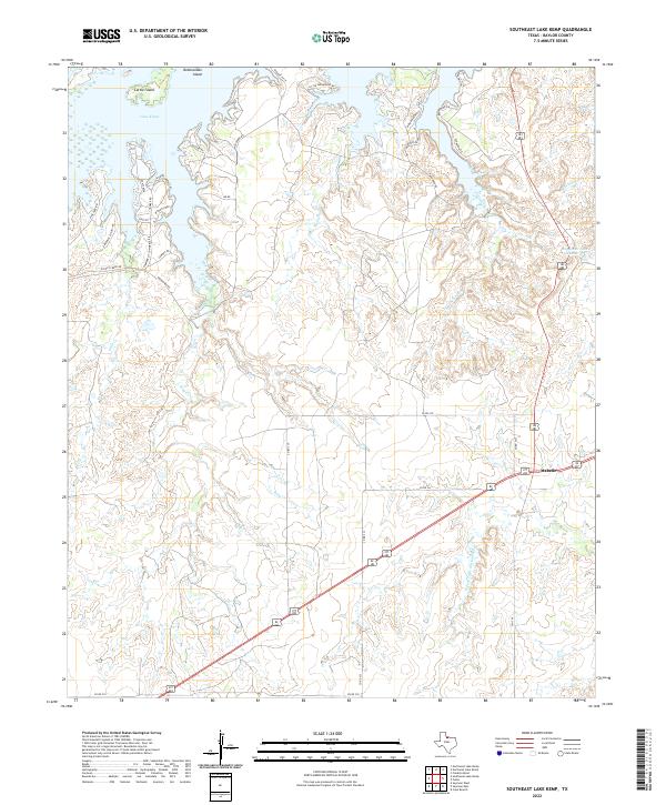
2022 Map of Southeast Lake Kemp
USGS Topo · Published 2022About this map
Lake Kemp dominates the northwestern corner of this Texas landscape, where its irregular shoreline is defined by points and islands like Cattle Island and Rattlesnake Island. The terrain is characterized by a dense network of creek drainages including Big Moonshine Cr, Little Moonshine Cr, and Pony Cr, which carve through the Baylor County plains. The small settlement of Mabelle sits at a prominent highway junction in the east, serving as a focal point for the surrounding ranching and rural infrastructure. A complex system of local roads, many bearing family and ranch names like Waggoner Rd, Maston Dr, and Wharton Dr, crisscrosses the area between the lake and the N Fork Little Wichita River. These routes highlight the deep history of land division and cattle operations in this region, with Waggoner Lake Number 5 further indicating the managed water resources essential to local industry.
Find a feature on this map
39 named features on this map. Tap any name to fly to it.
Don’t see what you’re looking for? This feature index may not catch every label — zoom into the map to look around manually.
Map Details
Editions of this 2022 Southeast Lake Kemp Map
This is the sole edition of this map. No revisions or reprints were ever made.
Other maps of this area

1954 · Wichita Falls
USGS Topo · 1:250,000

1958 · Wichita Falls
USGS Topo · 1:250,000

1966 · Franklin Bend
USGS Topo · 1:24,000

1966 · Seymour West
USGS Topo · 1:24,000

1966 · Fulda
USGS Topo · 1:24,000

1966 · Northeast Lake Kemp
USGS Topo · 1:24,000

1966 · Southeast Lake Kemp
USGS Topo · 1:24,000

1966 · Northwest Lake Kemp
USGS Topo · 1:24,000

1966 · Southwest Lake Kemp
USGS Topo · 1:24,000

1966 · Seymour East
USGS Topo · 1:24,000