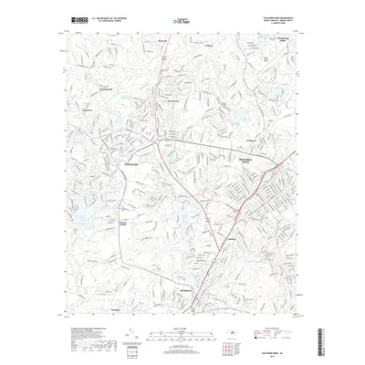
2019 Map of Southern Pines
USGS Topo · Published 2019About this map
Pinehurst and Southern Pines dominate this modern topographical record, showcasing a landscape defined by golf-oriented leisure, residential expansion, and educational hubs. The presence of the Sandhills Community College and Pinecrest School reflects the area's development as a regional center, while the Moore County Airport serves as a gateway to this famed recreational district. Smaller settlements such as Taylortown and Jackson Hamlet provide important context for local genealogy, situated near established landmarks like the Mount Hope Cemetery.
Find a feature on this map
399 named features on this map. Tap any name to fly to it.
Don’t see what you’re looking for? This feature index may not catch every label — zoom into the map to look around manually.
Map Details
Editions of this 2019 Southern Pines Map
This is the sole edition of this map. No revisions or reprints were ever made.
Other maps of this area

1942 · Troy
USGS Topo · 1:125,000

1948 · Southern Pines
USGS Topo · 1:62,500

1948 · Pinebluff
USGS Topo · 1:24,000

1948 · Mc Cain
USGS Topo · 1:24,000

1949 · West End
USGS Topo · 1:24,000

1949 · Hoffman
USGS Topo · 1:24,000

1949 · Jackson Springs
USGS Topo · 1:62,500

1950 · Sanatorium
USGS Topo · 1:24,000

1950 · Pine Bluff
USGS Topo · 1:24,000

1950 · Niagara
USGS Topo · 1:24,000