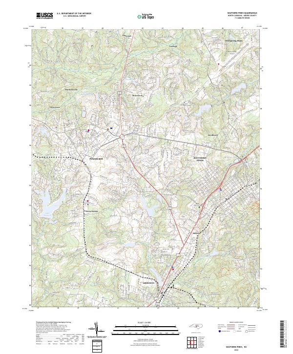
2022 Map of Southern Pines
USGS Topo · Published 2022About this map
Southern Pines and Pinehurst anchor this detailed landscape in Moore County, showcasing the region's established legacy of golf and resort planning. The modern infrastructure is evident in the dense network of residential streets and the proximity of the Moore County Airport, yet the map retains distinct smaller communities like Jackson Hamlet, Taylortown, and Murdocksville. Water remains a central geographic feature, with Lake Pinehurst and the Pinehurst Water Supply Reservoir providing significant landmarks within the sandhills terrain.
Find a feature on this map
338 named features on this map. Tap any name to fly to it.
Don’t see what you’re looking for? This feature index may not catch every label — zoom into the map to look around manually.
Map Details
Editions of this 2022 Southern Pines Map
This is the sole edition of this map. No revisions or reprints were ever made.
Historical Maps of Yadkin Trail Through Time
7 maps found