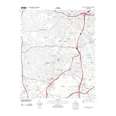
2011 Map of Southwest Atlanta
USGS Topo · Published 2011About this map
Fort McPherson and the sprawling Hartsfield-Jackson Atlanta International Airport anchor this 2011 survey of the city's southwestern corridor. The map details a densely developed urban and suburban landscape, where historic neighborhoods like Mechanicsville, Summerhill, and Peoplestown sit adjacent to the intricate highway interchanges near the Atlanta Central City Post Office. This era shows the established footprint of Clark Atlanta University and the Joel Chandler Harris Homes north of the residential blocks of West End.
Find a feature on this map
105 named features on this map. Tap any name to fly to it.
Don’t see what you’re looking for? This feature index may not catch every label — zoom into the map to look around manually.
Map Details
Editions of this 2011 Southwest Atlanta Map
This is the sole edition of this map. No revisions or reprints were ever made.
Other maps of this area

1888 · Atlanta
USGS Topo · 1:125,000

1890 · Atlanta
USGS Topo · 1:125,000

1891 · Marietta
USGS Topo · 1:125,000

1892 · Atlanta
USGS Topo · 1:125,000

1895 · Atlanta
USGS Topo · 1:125,000

1895 · Marietta
USGS Topo · 1:125,000

1897 · Marietta
USGS Topo · 1:125,000

1901 · Marietta
USGS Topo · 1:125,000

1953 · Atlanta
USGS Topo · 1:250,000

1954 · Conley
USGS Topo · 1:24,000