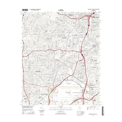
2014 Map of Southwest Atlanta
USGS Topo · Published 2014About this map
Atlanta's southern and western residential expansion is the primary focus of this study, anchored by historical neighborhoods such as Mechanicsville, Peoplestown, and West End. These urban centers give way to the sprawling infrastructure of Hartsfield - Jackson Atlanta International Airport, which occupies a significant portion of the southern landscape. The map provides a critical record for genealogists, featuring several extensive burial grounds including Westview Cem, Greenwood Cem, and Hillcrest Cem. Educational institutions like Spelman Coll, Atlanta Christian Coll, and Atlanta Metropolitan Coll are clearly defined, showing the distribution of academic life across the region. The map also delineates the complex transitions between communities such as East Point, College Park, and Hapeville, where the heavy industrial corridors of the South Side Industrial Pky SE meet residential enclaves like Blair Village and Mountain View.
Find a feature on this map
58 named features on this map. Tap any name to fly to it.
Don’t see what you’re looking for? This feature index may not catch every label — zoom into the map to look around manually.
Map Details
Editions of this 2014 Southwest Atlanta Map
This is the sole edition of this map. No revisions or reprints were ever made.
Other maps of this area

1888 · Atlanta
USGS Topo · 1:125,000

1890 · Atlanta
USGS Topo · 1:125,000

1891 · Marietta
USGS Topo · 1:125,000

1892 · Atlanta
USGS Topo · 1:125,000

1895 · Atlanta
USGS Topo · 1:125,000

1895 · Marietta
USGS Topo · 1:125,000

1897 · Marietta
USGS Topo · 1:125,000

1901 · Marietta
USGS Topo · 1:125,000

1953 · Atlanta
USGS Topo · 1:250,000

1954 · Conley
USGS Topo · 1:24,000