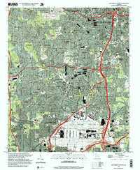
1997 Map of Southwest Atlanta
USGS Topo · Published 1999About this map
Hartsfield Atlanta International Airport dominates the southern landscape of this late-1990s survey, illustrating the massive scale of regional transportation infrastructure during a period of significant growth. The map captures a dense urban and suburban corridor south of Atlanta, where historic neighborhoods like West End and Cascade Heights meet major institutional grounds. Significant acreage is devoted to the Fort McPherson Military Reservation and sprawling memorial grounds, including Westview Cemetery and Greenwood Cemetery.
Find a feature on this map
81 named features on this map. Tap any name to fly to it.
Don’t see what you’re looking for? This feature index may not catch every label — zoom into the map to look around manually.
Map Details
Editions of this 1997 Southwest Atlanta Map
This is the sole edition of this map. No revisions or reprints were ever made.
Other maps of this area

1888 · Atlanta
USGS Topo · 1:125,000

1890 · Atlanta
USGS Topo · 1:125,000

1891 · Marietta
USGS Topo · 1:125,000

1892 · Atlanta
USGS Topo · 1:125,000

1895 · Atlanta
USGS Topo · 1:125,000

1895 · Marietta
USGS Topo · 1:125,000

1897 · Marietta
USGS Topo · 1:125,000

1901 · Marietta
USGS Topo · 1:125,000

1953 · Atlanta
USGS Topo · 1:250,000

1954 · Conley
USGS Topo · 1:24,000