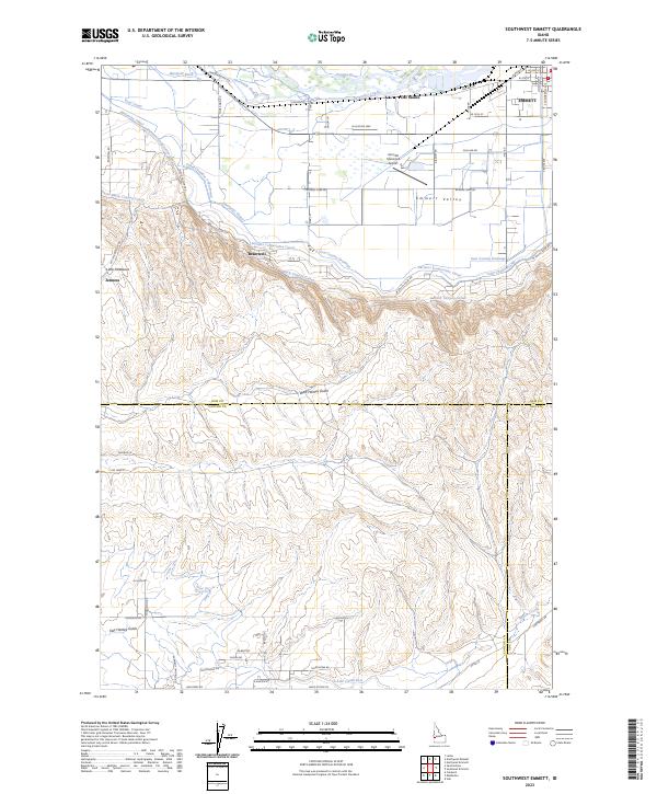
2023 Map of Southwest Emmett
USGS Topo · Published 2023About this map
Emmett Valley provides a distinct contrast between the irrigated agricultural floor and the rising uplands of Little Freezeout and West Hartley Gulch. The northern portion of the map is dominated by the Payette River and an intricate network of water management features including the Enterprise Canal, Farmers Cooperative Canal, and Maxfield Ditch. These waterways reflect the intensive irrigation history required to support settlements like Emmett, Del Monte, and Bramwell.
Find a feature on this map
65 named features on this map. Tap any name to fly to it.
Don’t see what you’re looking for? This feature index may not catch every label — zoom into the map to look around manually.
Map Details
Editions of this 2023 Southwest Emmett Map
This is the sole edition of this map. No revisions or reprints were ever made.
Other maps of this area

1892 · Boise
USGS Topo · 1:125,000

1897 · Boise
USGS Topo · 1:125,000

1898 · Nampa
USGS Topo · 1:125,000

1953 · Star
USGS Topo · 1:24,000

1953 · Montour
USGS Topo · 1:62,500

1955 · Boise
USGS Topo · 1:250,000

1958 · Boise
USGS Topo · 1:250,000
1958 · Middleton
USGS Topo · 1:24,000
1958 · Caldwell
USGS Topo · 1:24,000

1962 · Boise
USGS Topo · 1:250,000