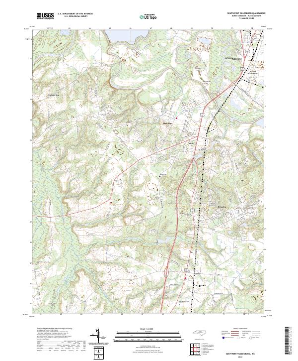
2022 Map of Southwest Goldsboro
USGS Topo · Published 2022About this map
The Neuse River winds across the northern landscape of Wayne County, defining the corridor between the city of Goldsboro and its southern outlying communities. This modern survey illustrates the established suburban and rural residential patterns of the area, where clusters of development like Mar-Mac and Genoa are situated between the river and several expansive swamp systems. The southern portion of the map is dominated by the wetlands of Thoroughfare Swamp and Brooks Swamp, showing how the natural hydrology of the coastal plain has shaped the local road network and settlement locations. Notable landmarks for genealogists and local historians include Rhodes Cem, Resthaven Memorial Park, and Wayne Memorial Park, alongside smaller named points of interest like Stevens Mill and Dudley. The map also captures the Neuse River Cut-Off and Big Ditch, indicating 21st-century water management efforts near the urban center.
Find a feature on this map
126 named features on this map. Tap any name to fly to it.
Don’t see what you’re looking for? This feature index may not catch every label — zoom into the map to look around manually.
Map Details
Editions of this 2022 Southwest Goldsboro Map
This is the sole edition of this map. No revisions or reprints were ever made.
Other maps of this area

1953 · Rocky Mount
USGS Topo · 1:250,000

1953 · Raleigh
USGS Topo · 1:250,000

1954 · Rocky Mount
USGS Topo · 1:250,000

1954 · Raleigh
USGS Topo · 1:250,000

1957 · Goldsboro
USGS Topo · 1:62,500

1957 · Seven Springs
USGS Topo · 1:62,500

1974 · Grantham
USGS Topo · 1:24,000

1974 · Northwest Goldsboro
USGS Topo · 1:24,000
1974 · Princeton
USGS Topo · 1:24,000

1974 · Southwest Goldsboro
USGS Topo · 1:24,000