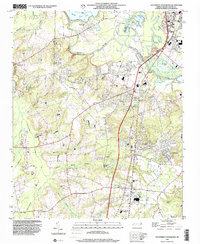
1998 Map of Southwest Goldsboro
USGS Topo · Published 2001About this map
The Neuse River defines the northern reaches of this landscape, its winding course punctuated by the Neuse River Cut-Off and flanked by industrial and municipal infrastructure like the sewage disposal ponds. South of the city, the terrain transitions into a mosaic of creek systems including Thoroughfare Creek, Falling Creek, and Brooks Swamp. This 1990s documentation reveals a dense network of residential clusters and rural crossroads, with numerous mobile home parks situated near established communities like Genoa and Brogden.
Find a feature on this map
55 named features on this map. Tap any name to fly to it.
Don’t see what you’re looking for? This feature index may not catch every label — zoom into the map to look around manually.
Map Details
Editions of this 1998 Southwest Goldsboro Map
This is the sole edition of this map. No revisions or reprints were ever made.
Other maps of this area

1953 · Rocky Mount
USGS Topo · 1:250,000

1953 · Raleigh
USGS Topo · 1:250,000

1954 · Rocky Mount
USGS Topo · 1:250,000

1954 · Raleigh
USGS Topo · 1:250,000

1957 · Goldsboro
USGS Topo · 1:62,500

1957 · Seven Springs
USGS Topo · 1:62,500

1974 · Grantham
USGS Topo · 1:24,000

1974 · Northwest Goldsboro
USGS Topo · 1:24,000
1974 · Princeton
USGS Topo · 1:24,000

1974 · Southwest Goldsboro
USGS Topo · 1:24,000