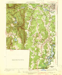
1942 Map of Southwick
USGS Topo · Published 1942About this map
Congamond Lakes anchor the southeastern corner of this study, marking a distinct chain of water along the Massachusetts-Connecticut border. The landscape transitions from the developed agricultural and residential pockets of Southwick and Westfield into the steep, wooded heights of Sodom Mountain and Seymour Mtn. This late 1930s era topography shows a region deeply connected to its water resources, featuring a series of catchments including the Westfield Reservoir and Farnham Reservoir, alongside the industrial presence of the New Haven and Hartford railroad line.
Find a feature on this map
84 named features on this map. Tap any name to fly to it.
Don’t see what you’re looking for? This feature index may not catch every label — zoom into the map to look around manually.
Map Details
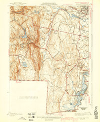
Editions of this 1942 Southwick Map
2 editions found
Other maps of this area

1886 · Springfield
USGS Topo · 1:62,500

1887 · Granville
USGS Topo · 1:62,500

1889 · Springfield
USGS Topo · 1:62,500

1889 · Granville
USGS Topo · 1:62,500

1892 · Hartford
USGS Topo · 1:62,500

1892 · Granby
USGS Topo · 1:62,500

1893 · Springfield
USGS Topo · 1:62,500

1893 · Granville
USGS Topo · 1:62,500

1895 · Springfield
USGS Topo · 1:62,500

1895 · Granville
USGS Topo · 1:62,500