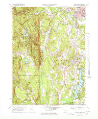
1972 Map of Southwick
USGS Topo · Published 1978About this map
Congamond Lakes anchor the southern border of this 1970s survey, straddling the state line between Massachusetts and Connecticut. This unique geography defines the landscape, where the waters of North Pond, Middle Pond, and South Pond provide a distinct recreational and residential corridor. To the west, the terrain rises sharply into the eastern Berkshires, marked by Sodom Mountain, Drake Mountain, and Bad Luck Mtn. This upland region serves as a critical watershed, containing the Granville Reservoir and Cooley Lake, which feed the streams flowing toward the Westfield River.
Find a feature on this map
54 named features on this map. Tap any name to fly to it.
Don’t see what you’re looking for? This feature index may not catch every label — zoom into the map to look around manually.
Map Details
Editions of this 1972 Southwick Map
4 editions found
Other maps of this area

1886 · Springfield
USGS Topo · 1:62,500

1887 · Granville
USGS Topo · 1:62,500

1889 · Springfield
USGS Topo · 1:62,500

1889 · Granville
USGS Topo · 1:62,500

1892 · Hartford
USGS Topo · 1:62,500

1892 · Granby
USGS Topo · 1:62,500

1893 · Springfield
USGS Topo · 1:62,500

1893 · Granville
USGS Topo · 1:62,500

1895 · Springfield
USGS Topo · 1:62,500

1895 · Granville
USGS Topo · 1:62,500