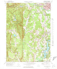
1972 Map of Southwick
USGS Topo · Published 1978About this map
The Little River and Westfield River converge in the northern portion of this survey, where the urban center of Westfield serves as a hub for the region's civic and healthcare infrastructure. The presence of The Noble Hospital, a Court House, and multiple specialized schools like the Vocational High Sch highlights the town's mid-century development. Moving south toward the Connecticut border, the landscape shifts toward recreational and rural features, including the Sodom Mtn Ski Area and the Edgewood Golf Course.
Find a feature on this map
84 named features on this map. Tap any name to fly to it.
Don’t see what you’re looking for? This feature index may not catch every label — zoom into the map to look around manually.
Map Details
Editions of this 1972 Southwick Map
4 editions found
Other maps of this area

1886 · Springfield
USGS Topo · 1:62,500

1887 · Granville
USGS Topo · 1:62,500

1889 · Springfield
USGS Topo · 1:62,500

1889 · Granville
USGS Topo · 1:62,500

1892 · Hartford
USGS Topo · 1:62,500

1892 · Granby
USGS Topo · 1:62,500

1893 · Springfield
USGS Topo · 1:62,500

1893 · Granville
USGS Topo · 1:62,500

1895 · Springfield
USGS Topo · 1:62,500

1895 · Granville
USGS Topo · 1:62,500