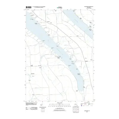
2010 Map of Spafford
USGS Topo · Published 2010About this map
Skaneateles Lake and Otisco Lake define the geography of this central New York region, where the steep, sculpted shorelines create a series of prominent landmarks such as Hardscrabble Point and Threemile Point. Small lakeside communities like Borodino Landing and Spafford Landing reflect the area's transition from early milling at sites like Gamble Mill to a landscape focused on summer recreation and residential life. The interior plateau is marked by a network of hamlets including Borodino, New Hope, and Kelloggsville, each anchored by historical burial grounds like the Borodino Cemetery and Kelloggsville Cemetery. A unique modern landmark, the Maus Marineland Seaplane Base, is situated on the eastern shore of Skaneateles Lake near Gregory Landing, while the natural drop of the terrain is captured at Carpenter Falls along Bear Swamp Creek.
Find a feature on this map
104 named features on this map. Tap any name to fly to it.
Don’t see what you’re looking for? This feature index may not catch every label — zoom into the map to look around manually.
Map Details
Editions of this 2010 Spafford Map
This is the sole edition of this map. No revisions or reprints were ever made.
Other maps of this area

1898 · Moravia
USGS Topo · 1:62,500

1899 · Skaneateles
USGS Topo · 1:62,500

1900 · Tully
USGS Topo · 1:62,500

1902 · Skaneateles
USGS Topo · 1:62,500

1902 · Moravia
USGS Topo · 1:62,500

1903 · Cortland
USGS Topo · 1:62,500

1943 · South Onondaga
USGS Topo · 1:31,680

1943 · Moravia
USGS Topo · 1:31,680

1943 · Spafford
USGS Topo · 1:31,680

1943 · Owasco
USGS Topo · 1:31,680