
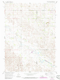
1960 Map of Spalding 2 NE
USGS Topo · Published 1962About this map
Beaver Creek winds through the rural heart of this landscape where Wheeler, Antelope, and Boone counties converge. The 1960 survey reveals a countryside defined by small-scale irrigation and decentralized education, featuring several flowing wells and a dense network of country schoolhouses. These small institutions, including Sunnyside Sch, Park Center Sch, and Valley View Sch, served the rural districts of Lincoln, Caldwell, and Oakland before the full consolidation of Nebraska's rural school systems. The presence of Park Ch and numbered sites like School No 3 and School No 27 provides a specific look at the social organization of these farming communities during the mid-20th century, a time when these local landmarks were the primary anchors for distant farmsteads.
Find a feature on this map
14 named features on this map. Tap any name to fly to it.
Don’t see what you’re looking for? This feature index may not catch every label — zoom into the map to look around manually.
Map Details
Editions of this 1960 Spalding 2 NE Map
3 editions found
Other maps of this area

1955 · Broken Bow
USGS Topo · 1:250,000

1955 · O'Neill
USGS Topo · 1:250,000

1956 · Broken Bow
USGS Topo · 1:250,000

1959 · O'Neill
USGS Topo · 1:250,000

1960 · Spalding 2 SW
USGS Topo · 1:24,000

1960 · Spalding 2 NW
USGS Topo · 1:24,000

1960 · Spalding 2 SE
USGS Topo · 1:24,000

1963 · Deloit
USGS Topo · 1:24,000

1963 · Deloit SW
USGS Topo · 1:24,000

1963 · Neligh SW
USGS Topo · 1:24,000