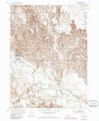
1954 Map of Spalding
USGS Topo · Published 1985About this map
Spalding sits at the junction of rail and river in this mid-century Nebraska landscape, where the Union Pacific line follows the broad valley carved by the Cedar River. This 1954 survey, updated with 1980s data, illustrates a classic Great Plains settlement pattern where towns grew alongside the tracks while rural life centered on local institutions like School No 4. The map provides a detailed view of the border between Greeley and Boone Counties, showing how the terrain shifts from the river bottomlands near Mud Creek into the dissected hills that dominate the northern half of the quadrangle. For those researching local history, the inclusion of St Michaels Cem and Dublin Cem serves as a vital record of the community's early generational roots. The presence of smaller named points like Freeman further defines the sparse but structured agricultural footprint of the era.
Find a feature on this map
11 named features on this map. Tap any name to fly to it.
Don’t see what you’re looking for? This feature index may not catch every label — zoom into the map to look around manually.
Map Details
Editions of this 1954 Spalding Map
3 editions found
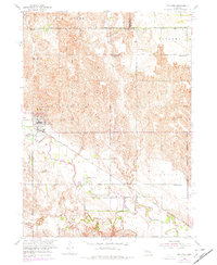
Other maps of this area

1954 · Cedar Rapids
USGS Topo · 1:24,000

1954 · Spalding
USGS Topo · 1:24,000

1954 · Spalding SW
USGS Topo · 1:24,000

1954 · Akron
USGS Topo · 1:24,000

1954 · Spalding NW
USGS Topo · 1:24,000

1954 · Spalding SE
USGS Topo · 1:24,000

1955 · Broken Bow
USGS Topo · 1:250,000

1956 · Broken Bow
USGS Topo · 1:250,000

1960 · Spalding 2 SW
USGS Topo · 1:24,000

1960 · Spalding 2 SE
USGS Topo · 1:24,000