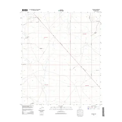
2013 Map of Spalding
USGS Topo · Published 2013About this map
The Mimbres River winds through this arid New Mexico landscape, shaping a network of ephemeral watercourses including San Vicente Arroyo and Lampbright Draw. The map is centered on the small settlement of Spalding, which serves as a junction for local roads like Co Road 0018 and Co Road 0019. The primary transit artery, Silver City Hwy NW, cuts diagonally across the terrain, reflecting the modern infrastructure overlaid on a historic travel corridor. This area’s deep connection to frontier history is marked by the Butterfield Trl in the northwest, a remnant of the mid-19th-century stagecoach route. Family-named landmarks and local tracks like Jones Spring Draw, Geronimo Rd, and Wells Fargo Dr suggest a landscape where ranching and early commerce dictated the placement of roads and homesteads.
Find a feature on this map
26 named features on this map. Tap any name to fly to it.
Don’t see what you’re looking for? This feature index may not catch every label — zoom into the map to look around manually.
Map Details
Editions of this 2013 Spalding Map
This is the sole edition of this map. No revisions or reprints were ever made.
Other maps of this area

1899 · Deming
USGS Topo · 1:125,000

1909 · Silver City
USGS Topo · 1:125,000

1915 · Deming
USGS Topo · 1:125,000

1947 · Faywood Station
USGS Topo · 1:24,000

1949 · Faywood Station
USGS Topo · 1:24,000

1954 · Silver City
USGS Topo · 1:250,000

1955 · Las Cruces
USGS Topo · 1:250,000

1956 · Dwyer
USGS Topo · 1:62,500

1958 · Las Cruces
USGS Topo · 1:250,000

1958 · Silver City
USGS Topo · 1:250,000