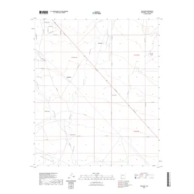
2023 Map of Spalding
USGS Topo · Published 2023About this map
The Mimbres River drainage defines this high-desert landscape in Luna County, where the legacy of early southwestern passage is etched into the modern road network. The historic Butterfield Trl crosses the northern portion of the quadrangle, paralleling modern routes like Forsyth Rd and Bartlett Rd. Small settlements and named locales such as Old Town and Spalding serve as focal points in an area dominated by intricate drainage systems, including San Vicente Arroyo and Lambright Draw. The map details a transition from flat basin lands toward more complex terrain like Provinger Canyon and La Jolla in the east. Local history researchers can trace the movement of water and travelers through this arid corridor, noting how landmarks like Jones Spring Draw and Antelope Draw have historically dictated the placement of roads and homesteads.
Find a feature on this map
30 named features on this map. Tap any name to fly to it.
Don’t see what you’re looking for? This feature index may not catch every label — zoom into the map to look around manually.
Map Details
Editions of this 2023 Spalding Map
This is the sole edition of this map. No revisions or reprints were ever made.
Other maps of this area

1899 · Deming
USGS Topo · 1:125,000

1909 · Silver City
USGS Topo · 1:125,000

1915 · Deming
USGS Topo · 1:125,000

1947 · Faywood Station
USGS Topo · 1:24,000

1949 · Faywood Station
USGS Topo · 1:24,000

1954 · Silver City
USGS Topo · 1:250,000

1955 · Las Cruces
USGS Topo · 1:250,000

1956 · Dwyer
USGS Topo · 1:62,500

1958 · Las Cruces
USGS Topo · 1:250,000

1958 · Silver City
USGS Topo · 1:250,000