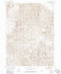
1954 Map of Spalding SE
USGS Topo · Published 1985About this map
Agricultural lands along the Greeley and Boone county line define this section of the Missouri River Basin during the mid-1950s. The landscape is carved by the North Branch and South Branch Timber Creek, which feed into the larger Timber Creek network. This survey reflects a period when rural education was still decentralized, evidenced by several local schoolhouses scattered across the township sections. These include Leo Valley Sch in the northwest, Enfield Sch central to the map, and Sleepy Hollow Sch further south. The Enfield Cemetery provides a focal point for genealogical interest, situated near the headwaters of the local drainage system. While the Cedar R clips the northeastern corner, the map is primarily characterized by the intricate contouring of the Nebraska loess hills and the transition from upland prairie to wooded creek bottoms.
Find a feature on this map
9 named features on this map. Tap any name to fly to it.
Don’t see what you’re looking for? This feature index may not catch every label — zoom into the map to look around manually.
Map Details
Editions of this 1954 Spalding SE Map
Other maps of this area

1899 · St. Paul
USGS Topo · 1:125,000

1954 · Cedar Rapids
USGS Topo · 1:24,000

1954 · Spalding
USGS Topo · 1:24,000

1954 · Spalding SW
USGS Topo · 1:24,000

1954 · Wolbach
USGS Topo · 1:24,000

1954 · Akron
USGS Topo · 1:24,000

1954 · Wolbach NE
USGS Topo · 1:24,000

1954 · Spalding NW
USGS Topo · 1:24,000

1954 · Belgrade NW
USGS Topo · 1:24,000

1954 · Spalding SE
USGS Topo · 1:24,000