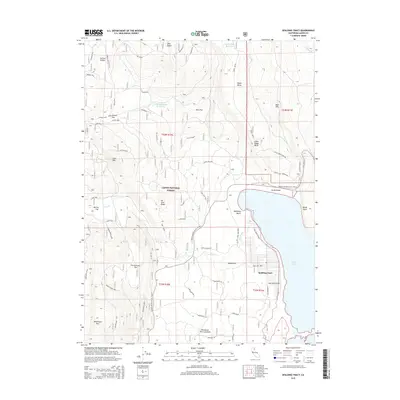
2015 Map of Spalding Tract
USGS Topo · Published 2015About this map
Spalding Tract sits on the western shore of Eagle Lake, marking a localized pocket of development within the expanse of the Lassen National Forest. This 2015 survey details a landscape where water and volcanic geology define the human footprint. To the south, the Brockman Flat Lava Beds and a network of forest roads like Whaleback Spur and Penitentiary Loop trace the irregular terrain near Whaleback Mtn. The shoreline features distinct recreational markers including Halfmoon Beach and Sandy Beach, leading toward the Pine Creek Estuary. Inland, water management is evident through the Signal Butte Reservoir and Hodseman Camp Reservoir, which support the high-desert environment. The presence of the Spalding Airport underscores the community's specialized access points in this corner of Lassen County.
Find a feature on this map
63 named features on this map. Tap any name to fly to it.
Don’t see what you’re looking for? This feature index may not catch every label — zoom into the map to look around manually.
Map Details
Editions of this 2015 Spalding Tract Map
This is the sole edition of this map. No revisions or reprints were ever made.
Other maps of this area

1886 · Honey Lake
USGS Topo · 1:250,000

1891 · Honey Lake
USGS Topo · 1:250,000

1893 · Honey Lake
USGS Topo · 1:250,000

1954 · Grasshopper Valley
USGS Topo · 1:62,500

1954 · Fredonyer Peak
USGS Topo · 1:62,500

1955 · Westwood
USGS Topo · 1:250,000

1956 · Hayden Hill
USGS Topo · 1:62,500

1956 · Antelope Mtn
USGS Topo · 1:62,500

1958 · Westwood
USGS Topo · 1:250,000

1959 · Westwood
USGS Topo · 1:250,000