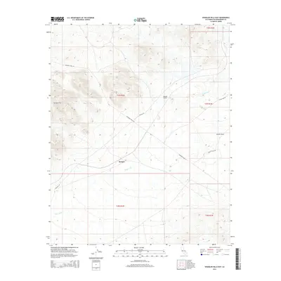
2015 Map of Spangler Hills East
USGS Topo · Published 2015About this map
Spangler sits within a wide desert basin, serving as a focal point for a network of backcountry routes that defined this section of the Mojave Desert in the early 21st century. The landscape is dominated by the Spangler Hills to the northwest and the low-lying expanse of the Searles Valley to the east. This survey captures the drainage patterns of Teagle Wash, which cuts across the central flats toward the valley floor. Transportation in this arid environment relies on established tracks like Randsburg Wash Rd and Pinnacle Rd, reflecting a period of land management where these corridors provided the primary access for mineral exploration and recreation. The mapping of township and range lines across the open terrain illustrates the structured division of public lands in San Bernardino County, where topographical relief is often the only break in the grid.
Find a feature on this map
14 named features on this map. Tap any name to fly to it.
Don’t see what you’re looking for? This feature index may not catch every label — zoom into the map to look around manually.
Map Details
Editions of this 2015 Spangler Hills East Map
This is the sole edition of this map. No revisions or reprints were ever made.
Other maps of this area

1903 · Randsburg
USGS Topo · 1:62,500

1911 · Randsburg
USGS Topo · 1:62,500

1912 · Randsburg
USGS Topo · 1:62,500

1915 · Searles Lake
USGS Topo · 1:250,000

1947 · Trona
USGS Topo · 1:250,000

1948 · Trona
USGS Topo · 1:250,000

1949 · Searles Lake
USGS Topo · 1:62,500

1950 · Searles Lake
USGS Topo · 1:62,500

1953 · Ridgecrest
USGS Topo · 1:62,500

1953 · Trona
USGS Topo · 1:250,000