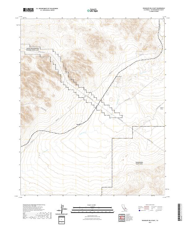
2021 Map of Spangler Hills East
USGS Topo · Published 2021About this map
Spangler Hills dominate the western portion of this arid landscape within the Mojave Desert. The map reveals a network of desert routes that reflect the area's history of mineral exploration and transit, most notably Stephens Mine Rd and the prominent Pinnacle Rd. These paths intersect near the settlement of Spangler, which sits at the junction of several washes and trails. The drainage of Teagle Wash cuts southeast across the terrain, illustrating the hydrological patterns of this high-desert environment. In the northeastern corner, the map reaches the edge of Searles Valley, a region long associated with salt and potash extraction. Access to this remote sector is provided by Searles Valley Rd and Randsburg Wash Rd, which facilitate movement between the local mines and broader transport corridors.
Find a feature on this map
15 named features on this map. Tap any name to fly to it.
Don’t see what you’re looking for? This feature index may not catch every label — zoom into the map to look around manually.
Map Details
Editions of this 2021 Spangler Hills East Map
This is the sole edition of this map. No revisions or reprints were ever made.
Other maps of this area

1903 · Randsburg
USGS Topo · 1:62,500

1911 · Randsburg
USGS Topo · 1:62,500

1912 · Randsburg
USGS Topo · 1:62,500

1915 · Searles Lake
USGS Topo · 1:250,000

1947 · Trona
USGS Topo · 1:250,000

1948 · Trona
USGS Topo · 1:250,000

1949 · Searles Lake
USGS Topo · 1:62,500

1950 · Searles Lake
USGS Topo · 1:62,500

1953 · Ridgecrest
USGS Topo · 1:62,500

1953 · Trona
USGS Topo · 1:250,000