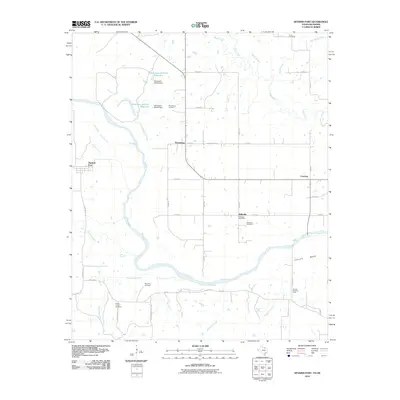
2010 Map of Spanish Fort
USGS Topo · Published 2010About this map
The Red River defines the border between Texas and Oklahoma in this 2010 topographic survey, winding through a landscape of agrarian settlements and riparian bottomlands. Rural communities like Belleville and Petersburg serve as local hubs, while the Courtney Post Office marks a persistent civic center for the surrounding ranchland. The area's complex burial history is well-documented through numerous family and community sites, including Mayfield Cemetery, Bourland Cemetery, and Liberty Chapel Cemetery.
Find a feature on this map
47 named features on this map. Tap any name to fly to it.
Don’t see what you’re looking for? This feature index may not catch every label — zoom into the map to look around manually.
Map Details
Editions of this 2010 Spanish Fort Map
This is the sole edition of this map. No revisions or reprints were ever made.
Other maps of this area

1901 · Addington
USGS Topo · 1:125,000

1901 · Ardmore
USGS Topo · 1:125,000

1902 · Gainesville
USGS Topo · 1:125,000

1905 · Montague
USGS Topo · 1:125,000

1918 · Ardmore
USGS Topo · 1:125,000

1943 · Gainesville
USGS Topo · 1:125,000

1954 · Sherman
USGS Topo · 1:250,000

1957 · Ardmore
USGS Topo · 1:250,000

1958 · Sherman
USGS Topo · 1:250,000

1963 · Ardmore
USGS Topo · 1:250,000