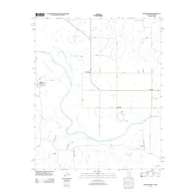
2013 Map of Spanish Fort
USGS Topo · Published 2013About this map
The Red River defines this borderland landscape, winding through a complex of tributaries and small agricultural communities in the early 21st century. Settlements like Belleville, Spanish Fort, and Petersburg are interconnected by a grid of rural routes such as N3050 Rd and E2110 Rd. The area is notably dense with burial grounds, including Bourland Cem, Petersburg Cem, and Liberty Chapel Cem, which offer significant data for genealogists tracking early families near the Oklahoma-Texas line. Industrial activity is centered on the Illinois Bend Oil Field in the southern portion of the map. Smaller water features like Village Cr, Mud Cr, and the Oknoname 067016 Reservoir punctuate the landscape, illustrating the hydrology of this riverine region.
Find a feature on this map
60 named features on this map. Tap any name to fly to it.
Don’t see what you’re looking for? This feature index may not catch every label — zoom into the map to look around manually.
Map Details
Editions of this 2013 Spanish Fort Map
This is the sole edition of this map. No revisions or reprints were ever made.
Other maps of this area

1901 · Addington
USGS Topo · 1:125,000

1901 · Ardmore
USGS Topo · 1:125,000

1902 · Gainesville
USGS Topo · 1:125,000

1905 · Montague
USGS Topo · 1:125,000

1918 · Ardmore
USGS Topo · 1:125,000

1943 · Gainesville
USGS Topo · 1:125,000

1954 · Sherman
USGS Topo · 1:250,000

1957 · Ardmore
USGS Topo · 1:250,000

1958 · Sherman
USGS Topo · 1:250,000

1963 · Ardmore
USGS Topo · 1:250,000