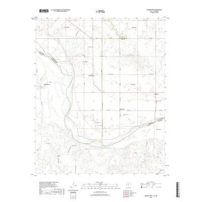
2019 Map of Spanish Fort
USGS Topo · Published 2019About this map
The Red River carves a winding path along the state line, defining the border between Oklahoma and Texas near the historic settlement of Spanish Fort. This landscape is shaped by the confluence of numerous watercourses, including Farmers Cr, Village Cr, and Mud Creek, which feed into the main river channel across the sandy floodplains. The map reveals a high concentration of pioneer-era burial sites, such as Mayfield Cem and Bourland Cem, which often represent the only remaining footprints of early family homesteads and vanished communities. Small inland hubs like Belleville and Petersburg are connected by a grid of rural roads, while Courtney sits near the eastern edge of the quadrangle. Significant water management is evident in the northern sections, marked by the 067015 Reservoir and 067016 Reservoir, which support the agricultural life of the surrounding plains.
Find a feature on this map
70 named features on this map. Tap any name to fly to it.
Don’t see what you’re looking for? This feature index may not catch every label — zoom into the map to look around manually.
Map Details
Editions of this 2019 Spanish Fort Map
This is the sole edition of this map. No revisions or reprints were ever made.
Other maps of this area

1901 · Addington
USGS Topo · 1:125,000

1901 · Ardmore
USGS Topo · 1:125,000

1902 · Gainesville
USGS Topo · 1:125,000

1905 · Montague
USGS Topo · 1:125,000

1918 · Ardmore
USGS Topo · 1:125,000

1943 · Gainesville
USGS Topo · 1:125,000

1954 · Sherman
USGS Topo · 1:250,000

1957 · Ardmore
USGS Topo · 1:250,000

1958 · Sherman
USGS Topo · 1:250,000

1963 · Ardmore
USGS Topo · 1:250,000