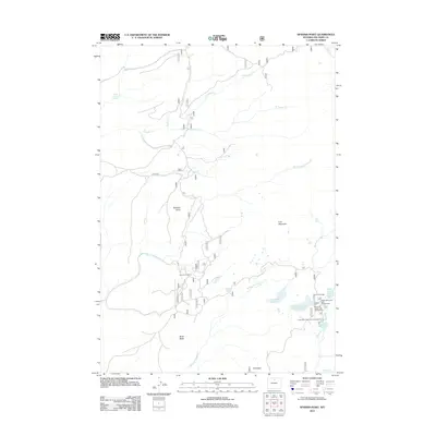
2012 Map of Spanish Point
USGS Topo · Published 2012About this map
Spanish Point and Iron Mountain anchor this high-elevation landscape in Big Horn County, where the terrain is defined by a dense network of mountain drainages and alpine lakes. The southeastern corner of the quadrangle serves as a recreational hub, featuring Upper Medicine Lodge Lake and Lower Medicine Lodge Lake, alongside the facilities at Paint Rock Lodge. This area is punctuated by specialized sites such as the Upper Paint Rock Lake Campground and Medicine Lodge Lake Campground, indicating a well-established pattern of seasonal access and outdoor activity near the forks of Medicine Lodge Cr and Trapper Cr. Further west, the presence of the Taylor Cow Camp reflects the continued importance of livestock management in the region's open spaces. The map also documents numerous smaller water sources and crossings, including White Bottom Spring and Johnny Cr, which illustrate the vital water-distribution patterns across this segment of the Wyoming wilderness.
Find a feature on this map
26 named features on this map. Tap any name to fly to it.
Don’t see what you’re looking for? This feature index may not catch every label — zoom into the map to look around manually.
Map Details
Editions of this 2012 Spanish Point Map
This is the sole edition of this map. No revisions or reprints were ever made.
Other maps of this area

1895 · Dayton
USGS Topo · 1:125,000

1898 · Bald Mountain
USGS Topo · 1:125,000

1899 · Cloud peak
USGS Topo · 1:125,000

1901 · Cloud Peak
USGS Topo · 1:125,000

1901 · Dayton
USGS Topo · 1:125,000

1901 · Bald Mountain
USGS Topo · 1:125,000

1955 · Sheridan
USGS Topo · 1:250,000

1958 · Sheridan
USGS Topo · 1:250,000

1960 · Shell Falls
USGS Topo · 1:24,000

1960 · Shell Lake
USGS Topo · 1:24,000