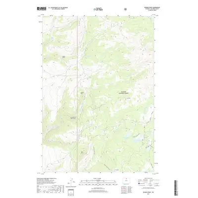
2017 Map of Spanish Point
USGS Topo · Published 2017About this map
The Bighorn National Forest dominates this high-altitude landscape in Big Horn County, where the topography is defined by dramatic shifts between mountain peaks and deep drainages. Spanish Point stands as a primary landmark, overlooking the complex water systems of Dry Medicine Lodge Canyon and Trapper Canyon. The map reveals a high-country environment where water management is visible through features like Upper Medicine Lodge Lake and Lower Medicine Lodge Lake, nestled within the Medicine Lodge Basin. Surveyors noted several family or local name-linked roads and trails, such as Edelman, N High Park, and Kinky White, which provide access to the various springs and creeks. This 2017 study illustrates the intersection of public land management and the natural water-shedding terrain of the Bighorn Mountains, including prominent summits like Iron Mtn and Black Butte.
Find a feature on this map
31 named features on this map. Tap any name to fly to it.
Don’t see what you’re looking for? This feature index may not catch every label — zoom into the map to look around manually.
Map Details
Editions of this 2017 Spanish Point Map
This is the sole edition of this map. No revisions or reprints were ever made.
Other maps of this area

1895 · Dayton
USGS Topo · 1:125,000

1898 · Bald Mountain
USGS Topo · 1:125,000

1899 · Cloud peak
USGS Topo · 1:125,000

1901 · Cloud Peak
USGS Topo · 1:125,000

1901 · Dayton
USGS Topo · 1:125,000

1901 · Bald Mountain
USGS Topo · 1:125,000

1955 · Sheridan
USGS Topo · 1:250,000

1958 · Sheridan
USGS Topo · 1:250,000

1960 · Shell Falls
USGS Topo · 1:24,000

1960 · Shell Lake
USGS Topo · 1:24,000