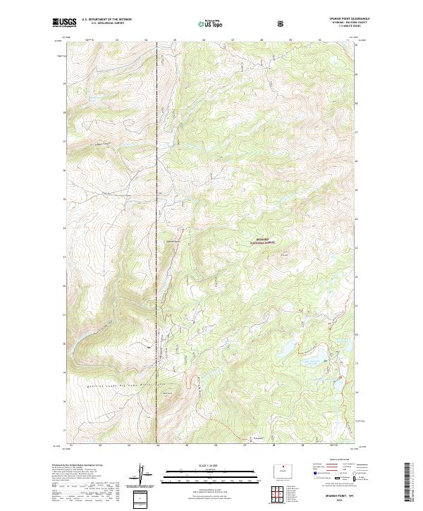
2021 Map of Spanish Point
USGS Topo · Published 2021About this map
Bighorn National Forest dominates this landscape in Big Horn County, characterized by a complex network of canyons and high-elevation lakes. The drainage system of Medicine Lodge Cr and Trapper Cr carves through the terrain, with Trapper Canyon and Dry Medicine Lodge Canyon marking significant geological features. This area is critically managed for wildlife, evidenced by the Medicine Lodge Big Game Winter Range which spans the southern portion of the survey. Higher elevations are marked by distinctive landmarks such as Spanish Point, Iron Mtn, and Black Butte. A network of historic routes including the Spanish Point Trl and Edelman Trl provides access to remote water bodies like Upper Medicine Lodge Lake and Upper Paint Rock Lake.
Find a feature on this map
37 named features on this map. Tap any name to fly to it.
Don’t see what you’re looking for? This feature index may not catch every label — zoom into the map to look around manually.
Map Details
Editions of this 2021 Spanish Point Map
This is the sole edition of this map. No revisions or reprints were ever made.
Other maps of this area

1895 · Dayton
USGS Topo · 1:125,000

1898 · Bald Mountain
USGS Topo · 1:125,000

1899 · Cloud peak
USGS Topo · 1:125,000

1901 · Cloud Peak
USGS Topo · 1:125,000

1901 · Dayton
USGS Topo · 1:125,000

1901 · Bald Mountain
USGS Topo · 1:125,000

1955 · Sheridan
USGS Topo · 1:250,000

1958 · Sheridan
USGS Topo · 1:250,000

1960 · Shell Falls
USGS Topo · 1:24,000

1960 · Shell Lake
USGS Topo · 1:24,000