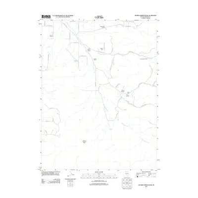
2011 Map of Spanish Springs Peak
USGS Topo · Published 2011About this map
Spanish Springs Peak anchors this corner of Washoe County, where the high desert terrain is etched by a series of drainages and seasonal water sources. The landscape is defined by its canyons, including Curnow Canyon and Right Hand Canyon to the north, which channel runoff into the larger Cottonwood Creek system. This 2011 survey reveals a quiet mix of ranching heritage and modern accessibility, with the Wilcox Ranch and the nearby Wofford Airport serving as primary landmarks in an area otherwise characterized by its natural features like Sugar Loaf.
Find a feature on this map
48 named features on this map. Tap any name to fly to it.
Don’t see what you’re looking for? This feature index may not catch every label — zoom into the map to look around manually.
Map Details
Editions of this 2011 Spanish Springs Peak Map
This is the sole edition of this map. No revisions or reprints were ever made.
Other maps of this area

1890 · Wadsworth
USGS Topo · 1:125,000

1891 · Reno
USGS Topo · 1:125,000

1892 · Wadsworth
USGS Topo · 1:125,000

1893 · Reno
USGS Topo · 1:125,000

1894 · Wadsworth
USGS Topo · 1:125,000

1957 · Sutcliffe
USGS Topo · 1:62,500
1957 · Vista
USGS Topo · 1:24,000

1957 · Spanish Springs Valley
USGS Topo · 1:62,500

1957 · Wadsworth
USGS Topo · 1:62,500

1957 · Nixon
USGS Topo · 1:62,500