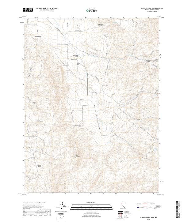
2021 Map of Spanish Springs Peak
USGS Topo · Published 2021About this map
The Pah Rah Range and Curnow Range dominate this desert landscape north of Reno, where steep canyons and high desert basins define the terrain. Rising to its namesake summit, Spanish Springs Peak anchors the southern portion of the sheet, looking over a network of isolated springs and drainage systems including Wildcat Spring and Wild Horse Spring. The presence of Warm Springs Valley and the prominent Sugar Loaf peak suggests a landscape defined by significant elevation changes and volcanic history typical of the Great Basin.
Find a feature on this map
66 named features on this map. Tap any name to fly to it.
Don’t see what you’re looking for? This feature index may not catch every label — zoom into the map to look around manually.
Map Details
Editions of this 2021 Spanish Springs Peak Map
This is the sole edition of this map. No revisions or reprints were ever made.
Other maps of this area

1890 · Wadsworth
USGS Topo · 1:125,000

1891 · Reno
USGS Topo · 1:125,000

1892 · Wadsworth
USGS Topo · 1:125,000

1893 · Reno
USGS Topo · 1:125,000

1894 · Wadsworth
USGS Topo · 1:125,000

1957 · Sutcliffe
USGS Topo · 1:62,500
1957 · Vista
USGS Topo · 1:24,000

1957 · Spanish Springs Valley
USGS Topo · 1:62,500

1957 · Wadsworth
USGS Topo · 1:62,500

1957 · Nixon
USGS Topo · 1:62,500