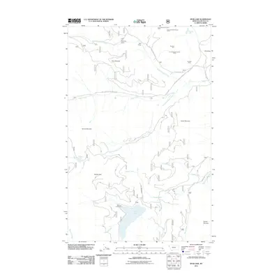
2011 Map of Spar Lake
USGS Topo · Published 2011About this map
Mining operations on Grouse Mountain define the industrial character of this Lincoln County landscape, as documented in 2011. Evidence of historical extraction is prominent in the northern reaches, including the Blue Bird Mine, the Bimetalic Mine, and three distinct sites for the Grouse Mountain Number 4 Mine enterprise. The area is heavily defined by its complex drainage systems, where Keeler Creek and its various forks converge, carving paths around Pony Mountain and Keeler Mountain.
Find a feature on this map
36 named features on this map. Tap any name to fly to it.
Don’t see what you’re looking for? This feature index may not catch every label — zoom into the map to look around manually.
Map Details
Editions of this 2011 Spar Lake Map
This is the sole edition of this map. No revisions or reprints were ever made.
Other maps of this area

1911 · Priest Lake
USGS Topo · 1:250,000

1913 · Priest Lake
USGS Topo · 1:250,000

1920 · Libby
USGS Topo · 1:125,000

1930 · Libby
USGS Topo · 1:125,000

1932 · Libby
USGS Topo · 1:125,000

1951 · Clark Fork
USGS Topo · 1:62,500

1951 · Mt Pend Oreille
USGS Topo · 1:62,500

1957 · Kalispell
USGS Topo · 1:250,000

1958 · Sandpoint
USGS Topo · 1:250,000

1960 · Kalispell
USGS Topo · 1:250,000